

October 2013. Our fourth wedding anniversary! We always go somewhere for our anniversary, even if we only have time for a long weekend. We have done Octoberfest in Helen, Georgia. Traveled up and down the Florida Keys. Hit National Parks from the Smokies to the Rockies. It is always a good time and one we often share with family and friends. October 2013 held so much promise! Travel with two of our favorites! Camping in Joshua Tree National Park… Hiking in Sequoia and Kings Canyon National Park…
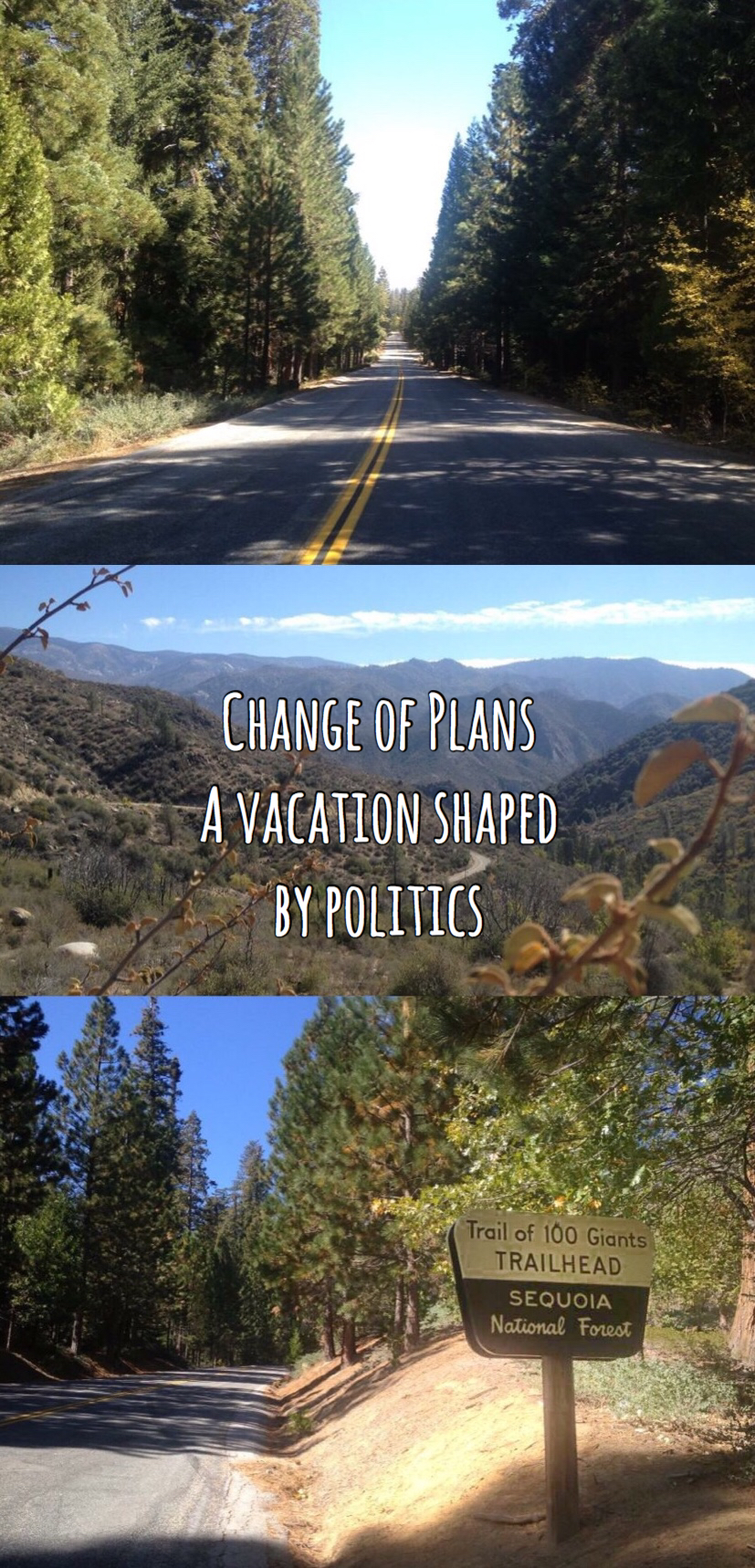
It just so happened that in October of 2013, the government reached a stalemate over funding for the Affordable Care Act and Congress failed to pass a budget. Republicans wouldn’t budge. Democrats wouldn’t budge. This isn’t about who was right or wrong, point is- less than a week before our trip, the national government shut down for the first time since 1996, taking the National Parks down with it.
My grandfather told me I shouldn’t get upset about politics. Chris reminds me what exactly he said when I’m getting upset about politics. And anyway, whichever side you were on at the time, you could probably have said your worst and elicit head nods from me. I was pissed at both sides.
It was selfish. There were nearly 800,000 people on furlough, sent home without pay. An additional 1.3 million people were asked to continue working, pay deferred. But me! I had a vacation planned!
After some obligatory cursing and gnashing of teeth, we resolved to make the best of it, and set out to recreate our trip. We needn’t have worried. Any grumbles were short lived. We discovered some gems that would never have been on our radar and a great time was had by all! I’m not suggesting you skip Joshua Tree. And I’m not implying Kings Canyon admission isn’t worth every penny. But I do want to highlight what we found when we were forced to dig deeper.
This is the story of the man not getting us down and how we salvaged our western park tour, besties in tow.
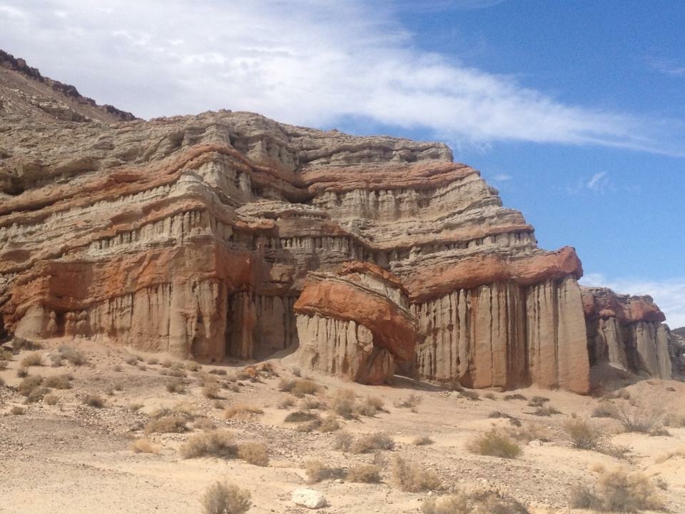
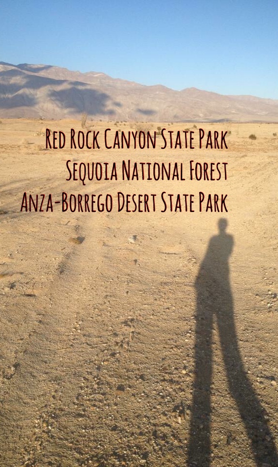
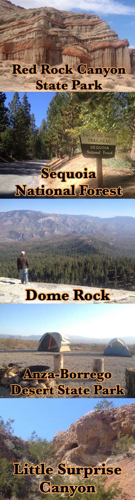
Red Rock Canyon State Park
Located in the high desert, near the town of Cantil, CA. There is a perhaps more widely known Red Rock Canyon National Conservation Area located about 15 miles west of Las Vegas, NV and when you are departing out of Los Angeles, your GPS may have a hard time accepting you are not going to that one. From L.A. you will travel almost due North for just under 2 hours. If your GPS starts sending you 4 hours Northeast, you may want to pull over and re-calibrate.
We were heart broken that we couldn’t go to Joshua Tree National Park. We almost went anyway. If the rangers had all been sent home, who would be there to kick us out? But Joshua Tree, the park, does not hold a monopoly over Joshua Tree, the plant, and we decided we wanted to see this tree, which was so different from anything in our middle Tennessee landscape and we set out to find another spot to view them. Enter Red Rock Canyon State Park.
Joshua trees galore!
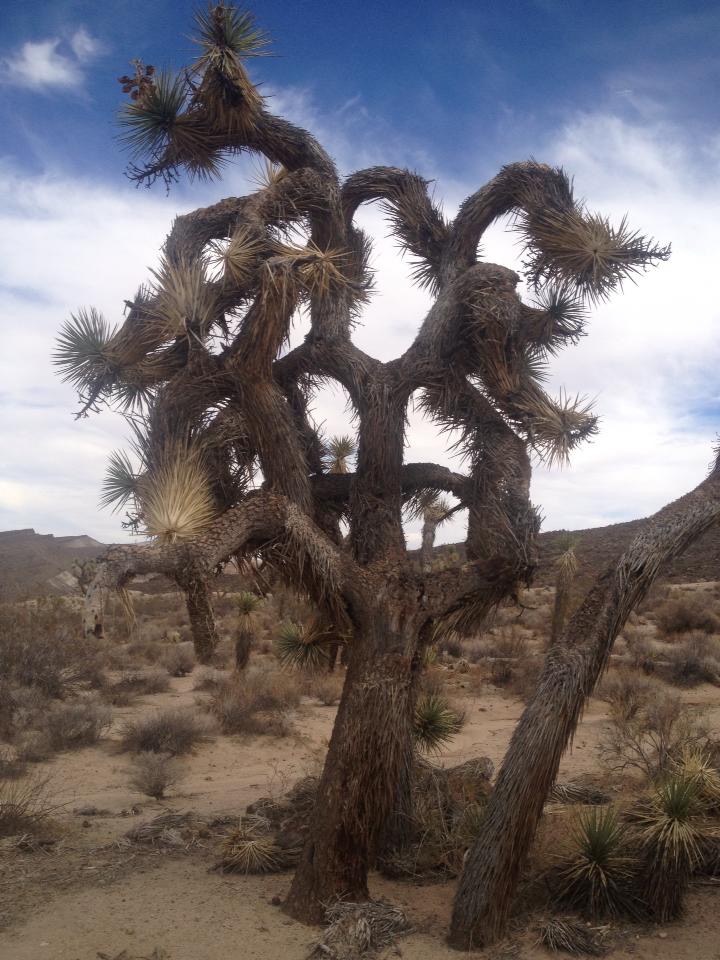
Classified as a Lily until recent DNA studies split up this huge family of plants into 40 separate families, the Joshua tree is now classified as a member of the Agave family. Yucca brevifolia.
Native only to the Mojave Desert which is almost 50,000 square miles, and encompasses Joshua Tree National Park, and ironically, both Red Rock Canyon State Park in California and Red Rock Canyon National Conservation Area in Nevada.
So we were in the high desert of the Mojave, much like Joshua Tree National Park. But the National Park actually straddles the high desert of the Mojave and the low desert of the Colorado while Red Rock Canyon melds the edge of the high desert with the foothills of the Sierra Nevada mountains. We have not been back to check out Joshua Tree National Park yet, but it remains high on the list. Because when you reach these extremes of landscapes, and you walk the border where two meet, you see something different, foreign, and maybe a little other-worldly. So while we have seen Joshua trees, we experienced something quite different.

The landscape along the way to Red Rock is increasingly sparse. Edwards Air Force Base appears suddenly after Lancaster, home to the U.S. Air Force Test Pilot School and NASA’s Armstrong Flight Research Center, and fades just as quickly as you creep north. Stop for concessions in Cantil and continue into the park. There is a bathroom at the welcome center with no roof on it! There are a few hikes you can take from the visitor center, which is closed during winter and summer months. There are campgrounds too and when we visited they seemed pretty quiet.
A couple of short hikes loop from the visitors center which are sandy, easy, and offer impressive views over the canyon. We only had enough time allotted for one of these short walks, but there are some much longer hikes as well as off-road driving trails that you might find of interest if you have more time to spend.
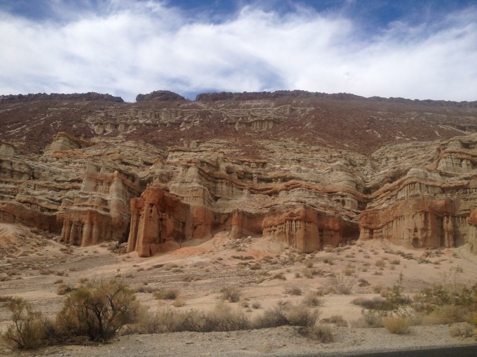
Red Rock Canyon’s namesake geological feature rises along the edges of its landscape. The striking layers of orange, red, and tan rocks are the result of erosion unearthing softer material beneath darker volcanic layers. It is a stunning and dramatic landscape that has been used as the backdrop in several Hollywood films including Westworld, The Mummy, and a scene out of Jurassic Park.
We would have liked to stay longer. The desert landscape is wide and transparent. It is more nuanced and textured in person than it ever comes across in photos. Living in the woods of Tennessee, it could not be more different than my natural habitat! So while we were not ready to leave, we had miles to go before nightfall so we hit the road.
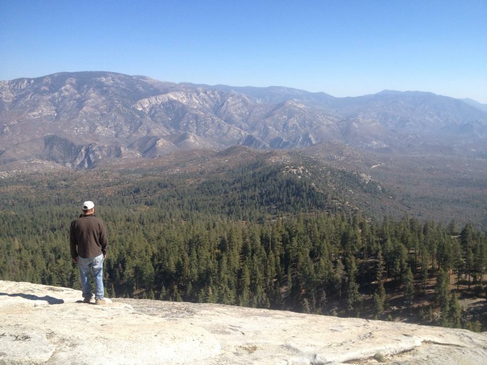
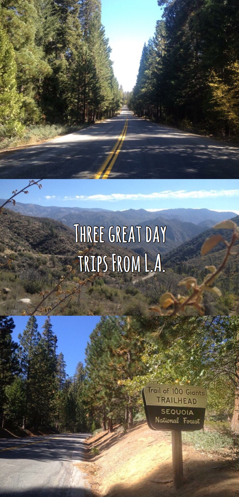
Sequoia National Forest
From Red Rock Canyon State Park, we traveled northwest, past Lake Isabella and followed the Kern river through Kernville, where we stopped for the night at Sequoia Lodge. We were pleasantly surprised by the Sequoia Lodge! I am a sucker for hotels that give you a real metal key instead of a key card. There were trails behind the lodge leading down to the water, giant pine cones littering the way. The Kern river is clear and cold and picturesque. Across the street from the Sequoia Lodge, the Riverkern General Store and Deli provided victuals for the night.
We were on our way to see the big trees. The original plan had us going to Sequoia National Park and Kings Canyon National Park. Thwarted again! However a little bit of research told us that while they could close the national park, they could not close the national forest. If a major highway goes through it, the road must stay open.

So, the next morning we set off through the forest. Mountain Highway 99 continues to follow the Kern River north through the forest before snaking westward and turning into Mountain Highway 50. You can’t go wrong driving through this beautiful area of the country and sure enough, the highway remained open. And quiet!
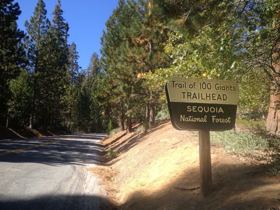
We got out to stretch our legs on the Trail of 100 Giants. We only saw one other group venturing out in hopes of walking amongst the giants. I guess a government shut down is one way to avoid crowds!

Pictures cannot capture it. Words cannot describe. There is something you feel when you are dwarfed by these ancient coniferous towers. A meditative quality that emanates, the patience that any tree possesses amplified to a palpable vibration of peace.
The Trail of 100 Giants is flat and paved with several loop options, roughly 1.3 miles in all. There are benches scattered throughout, allowing you to be still and behold. The trail meanders through a section of Long Meadow Grove which boasts its largest tree at 20 feet in diameter and 220 feet tall.
Some of the larger trees in the grove may be as much as 1,500 years old! Amazingly, the cones that give birth to these behemoths are small and compact, 1-1/2 to 2-1/2 inches long and the seeds they contain are only 4-5 mm long.
Sequoias have wide but shallow root systems, with no tap root. One wonders how they remain standing at all, let alone for millennia! It is said that their stability is aided by their well balanced growing habit and intricately tangled roots, making up for their lack of depth with an abundance of complexity. Not to say they don’t fall. You can see fallen sequoias on the Trail of 100 Giants, likely the victims of a wet winter and softer than normal ground. Seeing a Sequoia lying on the forest floor is heart-wrenching, but also gives you a whole new perspective on their magnitude.
Just about the time that the other couple showed up to venture onto the trail, we had resolved to break away from the spell that bound us and keep heading up the road. If you go to Sequoia, when it’s open of course, you can beat the crowds and find this same peace by getting an early start. By all accounts, you might only see a handful of groups on the Trail of 100 Giants at any given time, not the crowds you might expect from some larger attractions in Kings Canyon and Yosemite, however due to the accessibility of the short, flat, paved trail, you might find a bit more cacophony than we did, so plan to go early if you want the peace and quiet we found.
On our way out of the forest we visited Dome Rock. Another short, easy hike, only a half mile and 75 feet in elevation gain, but it is a big reward for such a small trek! I imagine this spot gets quite busy due to its brevity and price of admission (free!); even with the shut down we saw several groups.
Dome Rock is a 400 foot tall and 800 foot wide granite bald. It offers sweeping views of the Kern river valley and national forest below, as well as the Needles, a very popular rock climbing destination nearby. There are no guardrails, so proceed with caution. The slope of the rock is so slight that you can walk out to the edge and it continues to stretch before you the farther you go. Don’t be deceived, it does eventually drop off to the valley below. You should also take caution, and heed to the warnings to not throw rocks, and watch your step so as to not dislodge anything under foot. It is a popular destination for rock climbers who remain out of site on the rock face below you.

So, we had seen the high desert. We had seen the big trees. To round out our plans (and not be foiled by the man) we still had to camp in the low desert. Enter…
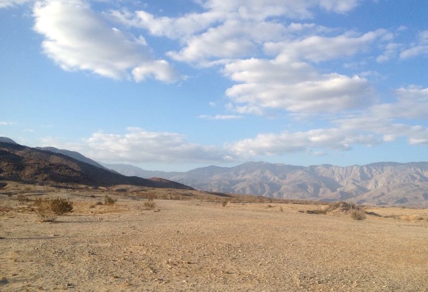
Anza-Borrego Desert State Park
We had returned from the forest to our base in Pasadena to spend time with family, gather camping gear, and eat soup dumplings, lots and lots of soup dumplings. When we emerged from our food coma we set out for Anza-Borrego, about 2-1/2 hours southeast of L.A. Anza-Borrego is located in the low Colorado Desert, defined as being under 2,000 feet in altitude. From Pasadena, we took the I-15 and exited in Temecula, following the 79 to San Felipe Rd. From there we forked onto Montezuma Valley Rd which descends over the ridge in increasingly tight switchbacks to Borrego Springs below. You can see for miles up here, which as fate would have it, would come in handy later.
Stop by the Park Visitor Center upon entering Borrego Springs, located at the west end of Palm Canyon Drive. The visitor center is situated mostly underground and surrounded by desert gardens. Knowledgeable staff and a large map help you get your bearings. There are a few developed campgrounds in Anza-Borrego State Park which cost around $25 per night, but primitive sites are free, and roadside camping is available throughout the park. We got the lay of the land and picked a roadside back-country spot with wide open sky and views of the surrounding mountains.
You should always familiarize yourself with park rules before setting out. Surprises can be a lot of fun, but not so much when you have traveled hours to camp, only to find yourself unprepared for the situation at hand. Thankfully, we had read up on the rules, not least of which is this: if you plan to have a camp fire, you must bring a metal pit to contain it. There are very few rules at this park, about where you can park, where pets are allowed, and the like, easy enough to abide by. Containing your campfire is one they take very seriously, with good reason.
With around 6 inches of rain each year, the Anza-Borrego landscape has rare opportunities to cleanse itself. So it takes a very, very long time to erase the charred scars of campfires from the ground. That, combined with the high winds and dry brush make it ripe for wildfires. This scene may look picturesque and perfect, but for most of the afternoon our tents were laid flat by the desert winds. Stay cautious and keep your fire fully contained in a metal pit.

Sometime shortly before dark, the wind stopped as abruptly as it had begun. We were able to stoke up the fire, cook dinner, and drink a few beers without getting sand in our mouths.
Turns out, in the desert the fun starts when the sun sets. We had a late addition to our party, joining us from Pasadena after work. Once again, we had planned ahead; what good scouts I travel with! We had armed ourselves with walkie talkies in case of poor cell service (you can count on that) and sometime after dark ours started crackling and chirping, surprising us from the forgotten pile of gear on our makeshift table.
Our late arrival had just crested the mountains bordering the park and was trying to figure out where we had found to camp. Daunting though it sounds in the largest state park in California, we had discussed a general locale before setting out, and remember what I said about seeing for miles? From roughly 12 miles away we watched headlights snake down the mountain. We checked in over the walkie talkie- “Did you just turn left?” “Yes, and I am about to go back right.” “Flash your lights…yes we see you!” We guided the headlights through the desert night all the way to our camp to much cheering and fanfare.
Our group complete, we sat up for hours watching the night sky. The Milky Way blazed above us. Shooting stars burst and sizzled, eliciting “oohs” and “ahhs”.
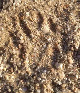
We couldn’t have been more pleasantly surprised by our camping companions, kit foxes! Averaging only around 5 pounds and 30 inches long, lighter but slightly longer than the average house cat, the kit fox is the smallest member of the Canidae family. Its small size is offset by its large ears, perfect for regulating body temperature, and the better to hear you with! They definitely noticed us before we noticed them, and followed us around camp all night. Stealthy little things, their eyes gave them away. Caught in the glare of a flashlight. Watching just outside our circle. Once we knew they were there, we watched for them all night, scanning the horizon with our flashlights to see what they were up to. Mainly just hanging out, being curious and super cute! The next morning revealed their tracks all over our site.
The next morning we broke down camp and had breakfast at Kendall’s Cafe in Borrego Springs. Self described as Mexican and American food (but also with all you can eat Pasta Monday!) this place is a slice out of the 70’s. No complaints though, breakfast hit the spot.
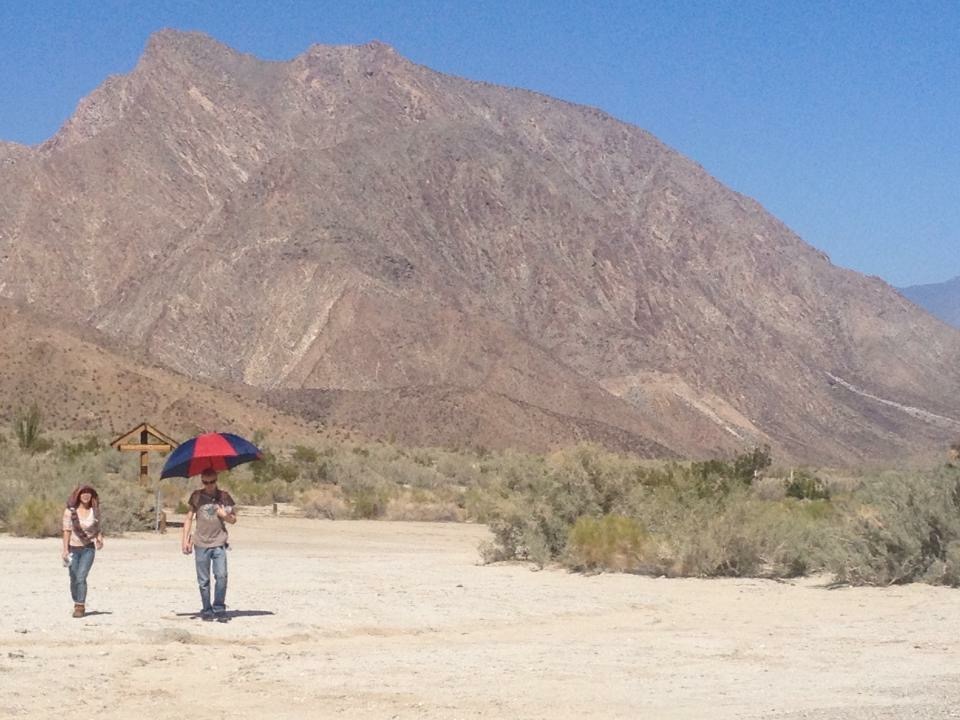
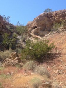
We fit in two hikes on our way out- The Narrows Earth Trail and Little Surprise Canyon at Hellhole Canyon.
Little Surprise Canyon is an easy 1.2 mile out and back that is favored for its abundance of wildflowers. While the 0.5 mile Narrows loop shows off the park’s unique geology. With a 20 minute drive in between, it is super easy to do both, but if you can only fit in one, I recommend Little Surprise. There is so much plant life to see! Do not be fooled by the stark appearance of the desert from a distance, it houses a lot of life. Not to call it hospitable! Bring water. Bring shade. Bring sunblock. If you have a baby strapped to your back, bring an umbrella!
It’s sunny and hot during the day, true to desert form. But don’t worry, it’s a dry heat.

For such a short hike, Little Surprise packs a lot in. Steep walls provide tons of visual interest and funnel the limited rainfall into a concentrated area, supporting an abundance of plant life. If you plan your trip for spring, you can catch the wildflowers blooming, but even in October there were plenty of diverse plants to see.
This was it. The culmination of months of planning, slashed then recreated over the course of a week. At times winging it at best.
National Parks are our greatest treasure. FDR said of them, “There is nothing so American as our national parks…. The fundamental idea behind the parks…is that the country belongs to the people, that it is in process of making for the enrichment of the lives of all of us.” We aspire to visit every one of them in our lifetimes and have made a decent start on it. But don’t rule out State Parks! Actually one of our favorite places on this planet is Baxter State Park in Maine.
More than anything, the take away for us was this: you have to roll with the punches. As I write this today, the word “shutdown” is again circulating in the media. Just this weekend a stop-gap funding bill was passed to push out budget negotiations to just before Christmas. By all means, feel something about that. Be passionate in your beliefs, and carry on healthy and respectful debates with your friends, family, and colleagues. But if (and when) something happens that is beyond your control, but that affects you personally, learn to roll with it. You will ultimately be a happier person with this skill in your toolbox, and you might be surprised by what you experience when a change of plans is approached with a sense of adventure and an open mind!
Have you been to a park mentioned in this article? Do you have a story to share about a change of plans that turned out okay in the end? We love to hear from you; please comment below!


What a great article! Loved how you made the best out of a bad situation, and gave me a glimpse into some amazing state parks that I’d likely never get to see for myself.
I’m getting to be a real pro at making lemonade out of lemons!